Exwick History Society
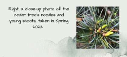
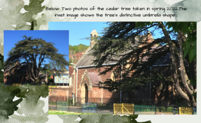
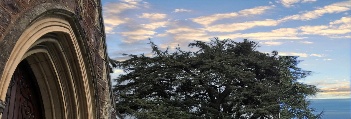
How old is the Cedar tree in St Andrew's Churchyard and do we know anything more about this magnificent tree ?
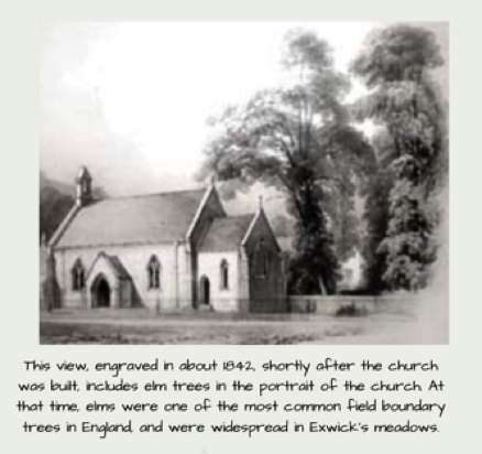
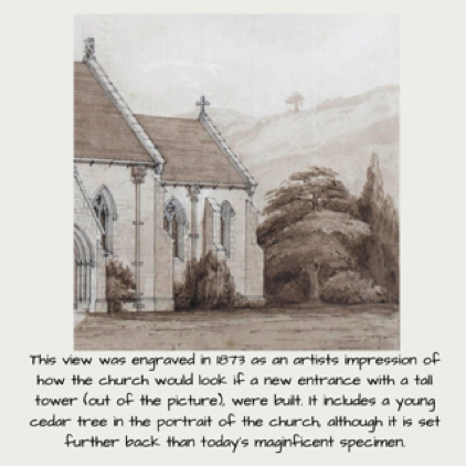
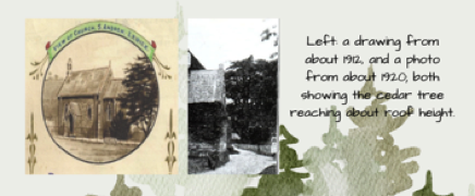
We were asked this question whilst planning our exhibition of 4th June 2022 (held as part of Exwick Parish Hall's events for the Queen's Platinum Jubilee), so we put together a poster summarising what we knew; but does anyone have any further information that might help ?

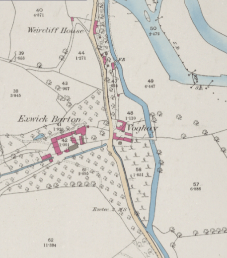
What is a Withy-bed and where was Exwick's ?
In riverside and flood-meadow locations, as at Exwick, beds of osier willows (withy beds) were grown for basket-making and other purposes. We put together a poster about this at our exhibition of 4th June 2022 and since that event some further information has surfaced.
The Ordnance Survey map for 1873-88 shows a site near Weircliffe House that was, at that date used for withy growing. The Ordnance Survey's map symbol for osier-beds is shown on their 1873-88 map on field no.58, which lies just below the small hamlet of Voghay (between the road from Exwick village to Cowley and the mill leat). You can read more about local map evidence for withy-beds here.
Where are the old Roman and Medieval coins that have been found in Exwick, kept ?
This question was asked at our history exhibition of 4th June 2022.
The coins that we included on our poster were based on information on the Devon County Council 'Historic Environment Record' website. One (the medieval abbey token) was found in a garden at The Hermitage about a hundred years ago and the other (the Roman coin) in more rural Exwick. We haven't been able to find out where these coins are today.... that remains a mystery in need of an answer !
Questions & Answers 1-5


map extract reproduced by permission of the National Library of Scotland
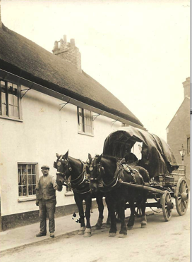
Where was the wonderful thatched cottage shown in many old photos of Exwick village ?
This question was asked by several people at our history exhibition of 4th June 2022. This thatched cottage, or cottages, stood on St Andrew's Road opposite the former Post Office (which is the prominent black-and-white building at the foot of Exwick Hill, built in 1893, and now in use as private houses). At one time it was known as 'Moore's Cottages' - after John Moore, who was appointed builder of St Andrew's Church, in 1841, on land he had previously leased as a pasture field from J. W. Buller Esq. of Downes.
Whilst Moore's Cottage(s) had an attractive frontage onto St Andrew's Road, it had no garden or yard behind; its back-wall appears to have dropped straight into the water of the Exwick leat behind, which must have made it very damp !

What do we know about the name 'Exwick' ?
Please read our article on the Home Page.
If you would then like to read further about this topic, please click here.
photo: Exwick Local History Society archive
Photos by Exwick Local History Society 2022
However, the benefit of being located directly on the mill leat may have outweighed this problem: it would have given Moore's Cottages a trouble-free sanitation solution at a time when not all dwelling houses were connected to a sewage disposal system or to a reliable one. Proper sanitary measures for Exwick and Cowick were only implemented following a local inquiry in 1848, which was energetically supported by W.H.Howard (the Vicar of St Thomas Parish -which, at this time, included the new chapel at Exwick- who was also Chairman of the Sanitary Committee).
Who lived at Moore's Cottages' ? We learn from the 1839 Tithe Survey that, at that date, it was occupied by Mr Moore on land owned by James Wentworth Buller. In the 1841 census he was described as a builder, then 35 years old, land was iving at the cottage with his wife Mary (35); and their five children, Elizabeth (9), Thomas (8), John (6), Mary (3), and Henry (3months). The household had one female-servant or maid, living-in: Sarah Baker (15). The later history of the house might be traced through subsequent census returns and directories.